ニュースレター
最新の画像、解析、測定に関するDigital Surfからのニュースを常に把握しておいてください。
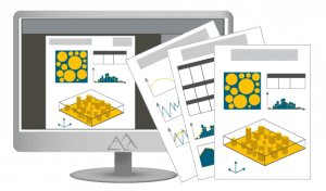
データの合流
複数の機器からのデータをまとめる
他のMountains®ユーザー(世界中の22,000以上のコミュニティ)が作成したライブ文書と解析の読み込み
ほぼすべてのタイプの表面および画像解析機器からのデータを処理(50以上の機器メーカーがMountains®ベースのソフトウェアパッケージを機器に付属)
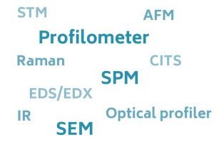
どの機器とも互換性を確保
処理データ:
以下をカバーする数百のファイル形式の読み込み
相関解析
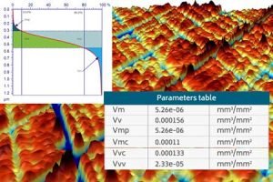
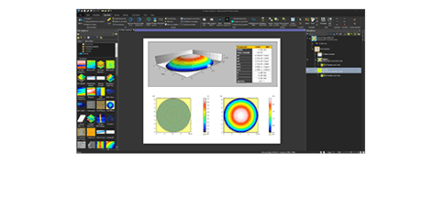
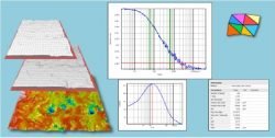
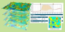
表面性状解析

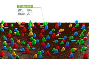
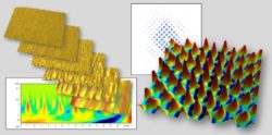
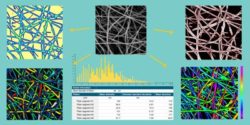
高度な粒子、繊維解析
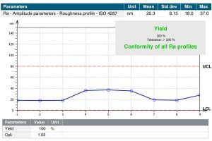
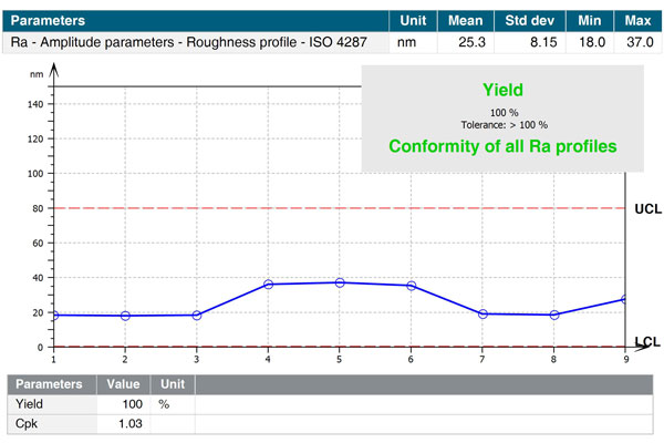
統計の生成
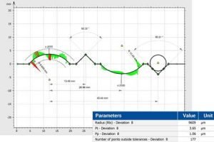
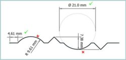
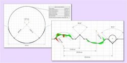
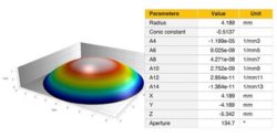
高機能輪郭解析
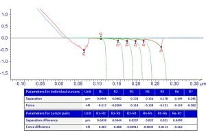
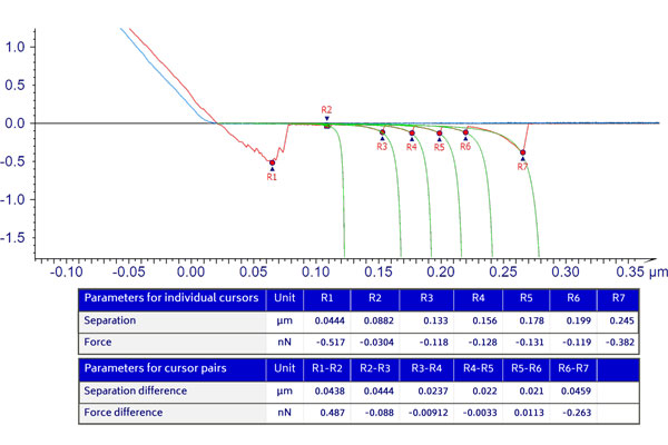
力分光法
分光技術のデータ処理

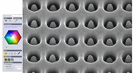
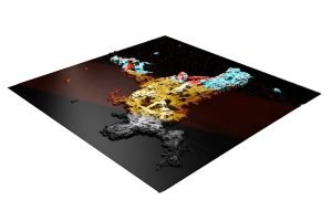
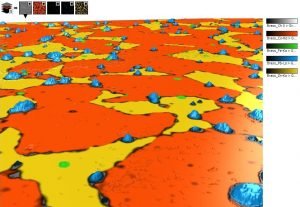
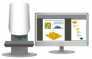
SEM画像着色
SEM画像に色を付けると、そこに含まれる情報の可視化と解釈が容易になるだけでなく、 公開する際の見た目の美しさも向上します。
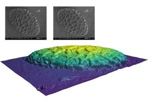
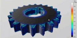
3D SEM画像再構築
学習と指導


|
MountainsLab® Premium |
MountainsLab® Expert |
|---|---|---|
|
機器の互換性 |
表面測定と画像機器の全タイプ: 2D/3D形状測定装置、走査電子顕微鏡、走査プローブ顕微鏡、分光計など。 |
|
主要機能 |
||
|
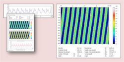
断面や表面の粗さ、うねりの解析 |
||
|
ステレオ画像または象限SEM画像からSEM画像着色&3D再構築 |
||
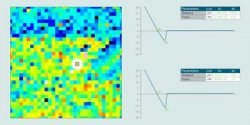
|
SPM画像解析用の補正ツール、パラメータ、フィルター |
||
|
スペクトルマップ処理、スペクトル画像補正およびエンハンスメント |
||
|
光学顕微鏡やその他の手法による画像の補正測定およびフィルタリングツール |
||
|
静的および動的母集団での統計解析 |
||
オプションモジュール |
||
|
高度な断面解析 |
||
|
自動車用断面パラメータ |
||
|
高度なトポグラフィー解析 |
||
|
粒子解析 |
||
|
相関解析 |
||
|
分光法 |
||
|
輪郭解析 |
Option | |
|
CAD比較を含む高度な輪郭解析 |
Option | |
|
フーリエとウェーブレット解析 |
Option | |
|
画像およびトポグラフィーの繊維解析 |
Option | |
|
レンズ解析 |
Option | |
|
フォースカーブと応力容量解析 |
Option | |
|
IV分光法 |
Option | |
|
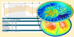
厚さ分析 |
Option | |
|
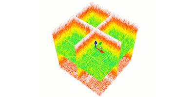
4D表面変化解析 |
Option | |
|
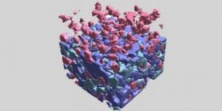
ケミカルキューブ |
Option | |
|
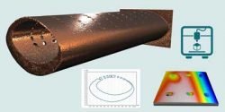
シェル(自由曲面)のサポート |
Option | |
|
計測解析のためのシェルトポグラフィー |
Option | |
|
シェルCAD比較 |
Option | Option |
|
スケールの影響を受けるフラクタル解析 |
Option | Option |
|
リード解析(ツイスト) |
Option | Option |
MountainsLab®では、高度かつ特別なアプリケーションに向けた以下のオプションモジュールがあります。